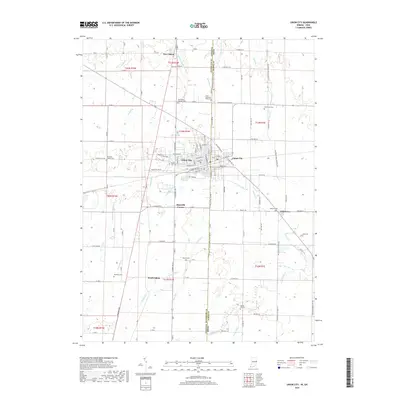
2019 Map of Union City
USGS Topo · Published 2019About this map
Union City straddles the state line in this survey of the Indiana-Ohio border region, serving as the primary hub for the surrounding agricultural townships. The landscape is defined by an intricate network of drainage ditches and small waterways, such as Little Ditch and O'Conner Ditch, which manage the headwaters of the Little Mississinewa River and Greenville Creek. This water management system is essential to the local farming economy, which is supported by a rigid grid of rural roads like E State Rd 32 and E-Union City Pike.
Find a feature on this map
77 named features on this map. Tap any name to fly to it.
Don’t see what you’re looking for? This feature index may not catch every label — zoom into the map to look around manually.
Map Details
Editions of this 2019 Union City Map
This is the sole edition of this map. No revisions or reprints were ever made.
Other maps of this area

1908 · St. Henry
USGS Topo · 1:62,500

1915 · Fort Recovery
USGS Topo · 1:48,000

1916 · Winchester
USGS Topo · 1:48,000

1918 · Winchester
USGS Topo · 1:62,500

1918 · Fort Recovery
USGS Topo · 1:62,500

1943 · Winchester
USGS Topo · 1:62,500

1953 · Muncie
USGS Topo · 1:250,000

1956 · Muncie
USGS Topo · 1:250,000

1960 · Union City
USGS Topo · 1:24,000
1960 · Spartanburg
USGS Topo · 1:24,000