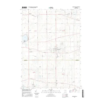
2016 Map of Union Grove
USGS Topo · Published 2016About this map
The Union Grove village core serves as the central hub of this agricultural landscape at the border of Racine and Kenosha counties. The 2016 survey details a region defined by its small settlements and water systems, including the Des Plaines River and the headwaters of the Root River. Significant local history is preserved at numerous religious and community sites, such as the Paris Corners Cem and Saint Francis Xavier Church Cem near Brighton. To the west, the residential and recreational character of Eagle Lake contrasts with the surrounding farm tracts, while Olson's Airport reflects the rural infrastructure of the early 21st century. The map traces the transition from these established village centers like Kansasville and Yorkville into the open drainage basins of the W Br Root River Canal, illustrating the modern layout of these long-standing Wisconsin townships.
Find a feature on this map
87 named features on this map. Tap any name to fly to it.
Don’t see what you’re looking for? This feature index may not catch every label — zoom into the map to look around manually.
Map Details
Editions of this 2016 Union Grove Map
This is the sole edition of this map. No revisions or reprints were ever made.
Other maps of this area

1891 · Bayview
USGS Topo · 1:62,500

1891 · Muskego
USGS Topo · 1:62,500

1892 · Racine
USGS Topo · 1:62,500

1893 · Silver Lake
USGS Topo · 1:62,500

1901 · Bayview
USGS Topo · 1:62,500

1901 · Muskego
USGS Topo · 1:62,500

1905 · Racine
USGS Topo · 1:62,500

1906 · Silver Lake
USGS Topo · 1:62,500

1954 · Rockford
USGS Topo · 1:250,000

1955 · Rockford
USGS Topo · 1:250,000