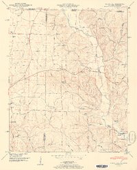
1951 Map of Union Hill
USGS Topo · Published 1951About this map
The borderlands of Alabama and Tennessee are captured here in the years following the expansion of the Tennessee Valley Authority. This landscape is defined by the winding course of Sugar Creek and the southern influence of the Wheeler Reservoir, where the map documents the Wheeler Reservoir Reservation boundary. Rural life in 1951 centers on a dense network of country churches and schools, including Hester Chapel near Lester and Carriger Sch further south. The presence of Ridgway Mill along Dobbins Branch suggests the persistence of local water-powered industry, while the terrain transitions from the elevations of Gray Ridge down toward the Elk River floodplains. Genealogists will find significant value in the documentation of family-named landmarks like McCravy Cem and Todd Cem, and small rural clusters such as Scarce Grease and Mt Rozell.
Find a feature on this map
68 named features on this map. Tap any name to fly to it.
Don’t see what you’re looking for? This feature index may not catch every label — zoom into the map to look around manually.
Map Details
Editions of this 1951 Union Hill Map
2 editions found
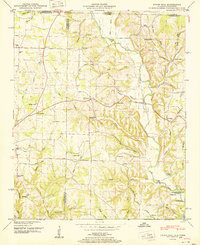
Other maps of this area

1914 · Rogersville
USGS Topo · 1:48,000

1916 · Rogersville
USGS Topo · 1:62,500

1936 · Union Hill
USGS Topo · 1:24,000

1936 · Aspen Hill
USGS Topo · 1:24,000

1936 · Thorntontown
USGS Topo · 1:24,000

1936 · Lexington
USGS Topo · 1:24,000

1936 · Ripley
USGS Topo · 1:24,000

1936 · Appleton
USGS Topo · 1:24,000

1936 · Cairo
USGS Topo · 1:24,000

1936 · Bonnertown
USGS Topo · 1:24,000