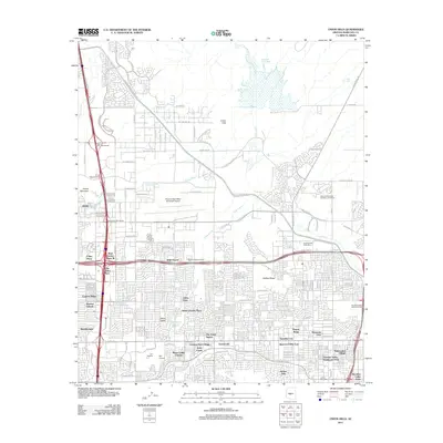
2011 Map of Union Hills
USGS Topo · Published 2011About this map
The Union Hills and Adobe Mountain rise above the dense residential developments of north Phoenix in the early twenty-first century. This landscape is defined by its water management and transportation infrastructure, dominated by the N Black Canyon Hwy and the extensive Central Arizona Project CSR canal system. The northern reaches remain less developed, featuring the Cave Creek Reservoir and the Cave Buttes Rec Area, while the southern half of the quadrangle is a grid of suburban neighborhoods including Moon Valley, Paradise City, and Wild Flower. Aviation is a central theme, with the sprawling Phoenix Deer Valley Municipal Airport and the smaller Turf Airport serving the region. Religious and commemorative sites like the National Memorial Cemetery of Arizona and Phoenix Memorial Park provide significant local landmarks amidst the rapid residential growth of Maricopa County.
Find a feature on this map
99 named features on this map. Tap any name to fly to it.
Don’t see what you’re looking for? This feature index may not catch every label — zoom into the map to look around manually.
Map Details
Editions of this 2011 Union Hills Map
This is the sole edition of this map. No revisions or reprints were ever made.
Other maps of this area

1904 · Camelback
USGS Topo · 1:62,500

1906 · Camelsback
USGS Topo · 1:62,500

1930 · Cave Creek
USGS Topo · 1:125,000

1939 · Cave Creek
USGS Topo · 1:125,000

1954 · Phoenix
USGS Topo · 1:250,000

1954 · Mesa
USGS Topo · 1:250,000

1957 · Mesa
USGS Topo · 1:250,000

1957 · Phoenix
USGS Topo · 1:250,000

1957 · Hedgpeth Hills
USGS Topo · 1:24,000

1957 · Glendale
USGS Topo · 1:24,000