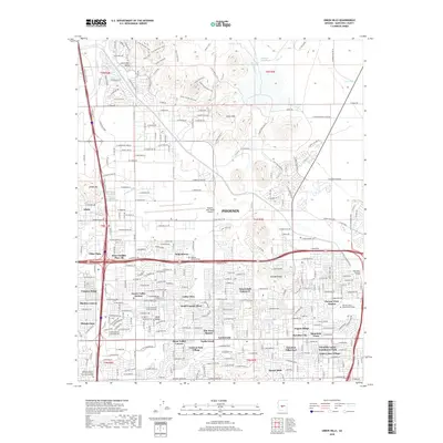
2018 Map of Union Hills
USGS Topo · Published 2018About this map
Phoenix exhibits significant suburban expansion northward in this 2018 survey, centered on the Union Hills and the massive infrastructure of the Central Arizona Project Aqueduct. Residential development is highly organized into named communities such as Moon Valley, Little Deer Valley, and Desert Valley Estates, reflecting the rapid growth of the North Valley area. The Phoenix Deer Valley Airport serves as a major logistical anchor in the center of the map, while the Paradise Valley Community College and Buffalo Ridge park provide essential community services and recreation.
Find a feature on this map
275 named features on this map. Tap any name to fly to it.
Don’t see what you’re looking for? This feature index may not catch every label — zoom into the map to look around manually.
Map Details
Editions of this 2018 Union Hills Map
This is the sole edition of this map. No revisions or reprints were ever made.
Other maps of this area

1904 · Camelback
USGS Topo · 1:62,500

1906 · Camelsback
USGS Topo · 1:62,500

1930 · Cave Creek
USGS Topo · 1:125,000

1939 · Cave Creek
USGS Topo · 1:125,000

1954 · Phoenix
USGS Topo · 1:250,000

1954 · Mesa
USGS Topo · 1:250,000

1957 · Mesa
USGS Topo · 1:250,000

1957 · Phoenix
USGS Topo · 1:250,000

1957 · Hedgpeth Hills
USGS Topo · 1:24,000

1957 · Glendale
USGS Topo · 1:24,000