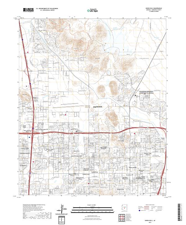
2021 Map of Union Hills
USGS Topo · Published 2021About this map
Union Hills and Adobe Mtn define the northern desert landscape of Phoenix in this modern survey, where residential growth meets the rugged Sonoran terrain. The extensive Central Arizona Project Aqueduct cuts across the northwestern corner near Little Deer Valley, illustrating the critical infrastructure supporting this arid region. Significant recreational and memorial spaces are prominent, including the National Memorial Cemetery of Arizona and the Holy Redeemer Cem to the east. The map shows a transition from high-density neighborhoods like Rose Garden Place III and Villas Plaza to the open trails of the northern ridges, such as the Desert Tortoise Trl and Secret Trl. Aviation activity is anchored by the Phoenix Deer Valley Airport, while education and community hubs like Paradise Valley Community College mark the southeastern suburban expansion.
Find a feature on this map
236 named features on this map. Tap any name to fly to it.
Don’t see what you’re looking for? This feature index may not catch every label — zoom into the map to look around manually.
Map Details
Editions of this 2021 Union Hills Map
This is the sole edition of this map. No revisions or reprints were ever made.
Other maps of this area

1904 · Camelback
USGS Topo · 1:62,500

1906 · Camelsback
USGS Topo · 1:62,500

1930 · Cave Creek
USGS Topo · 1:125,000

1939 · Cave Creek
USGS Topo · 1:125,000

1954 · Phoenix
USGS Topo · 1:250,000

1954 · Mesa
USGS Topo · 1:250,000

1957 · Mesa
USGS Topo · 1:250,000

1957 · Phoenix
USGS Topo · 1:250,000

1957 · Hedgpeth Hills
USGS Topo · 1:24,000

1957 · Glendale
USGS Topo · 1:24,000