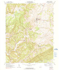
1971 Map of Union
USGS Topo · Published 1991About this map
The town of Union serves as the focal point of this Monroe County landscape, situated where the karst-rich valley floor meets the rising elevations of the Wolf Creek Knobs and Swoopes Knobs. In the early 1970s, the area maintained a distinctively rural character, defined by small settlements like Salt Sulphur Springs and Lillydale. The community's social fabric is visible through a high concentration of historic local institutions, including Rehoboth Ch, Mount Pleasant Ch, and Marvin Chapel.
Find a feature on this map
45 named features on this map. Tap any name to fly to it.
Don’t see what you’re looking for? This feature index may not catch every label — zoom into the map to look around manually.
Map Details
Editions of this 1971 Union Map
2 editions found
Other maps of this area

1887 · Hinton
USGS Topo · 1:125,000

1887 · Lewisburg
USGS Topo · 1:125,000

1890 · Dublin
USGS Topo · 1:125,000

1890 · Christiansburg
USGS Topo · 1:125,000

1891 · Lewisburg
USGS Topo · 1:125,000

1891 · Dublin
USGS Topo · 1:125,000

1892 · Hinton
USGS Topo · 1:125,000

1921 · Alderson
USGS Topo · 1:48,000

1921 · Ronceverte
USGS Topo · 1:48,000

1923 · Ronceverte
USGS Topo · 1:62,500