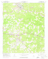
1965 Map of Union Point
USGS Topo · Published 1975About this map
Union Point serves as the primary rail and road hub in this mid-1960s survey of eastern Greene County. The landscape is defined by the headwaters of the North Fork Ogeechee River and South Fork Ogeechee River, where the Piedmont terrain transitions into a complex of small farms and family landmarks. Cultural sites are prominent, ranging from the Wesleyan Campground and Buffalo Lick Mon to numerous country churches like Bethel Ch and Brown Chapel. Educational life is anchored by the Darden-Thomas Sch and Hubert English Sch, while the town of Siloam sits further south along the Georgia Railroad line. The map captures an era of rural Georgia before major interstate development, showing the original footprints of settlements like Jefferson Hall and a network of traditional cemeteries, including the descriptively named Saw Dust Cem.
Find a feature on this map
42 named features on this map. Tap any name to fly to it.
Don’t see what you’re looking for? This feature index may not catch every label — zoom into the map to look around manually.
Map Details
Editions of this 1965 Union Point Map
3 editions found
Other maps of this area

1906 · Crawfordville
USGS Topo · 1:125,000

1953 · Athens
USGS Topo · 1:250,000

1958 · Athens
USGS Topo · 1:250,000

1959 · Athens
USGS Topo · 1:250,000

1963 · Athens
USGS Topo · 1:250,000

1965 · Woodville
USGS Topo · 1:24,000

1965 · Union Point
USGS Topo · 1:24,000

1966 · Philomath
USGS Topo · 1:24,000

1966 · Crawfordville
USGS Topo · 1:24,000

1972 · Penfield
USGS Topo · 1:24,000