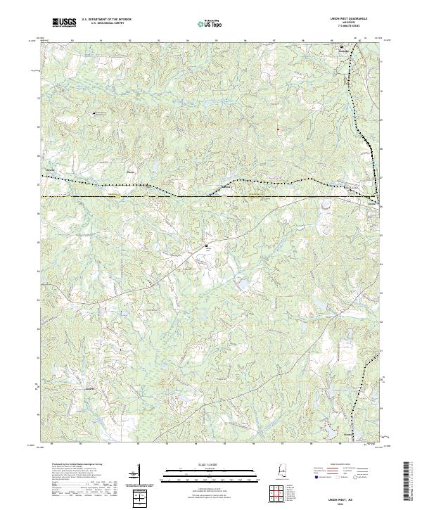
2024 Map of Union West
USGS Topo · Published 2024About this map
The boundary between Neshoba Co and Newton Co bisects this landscape of small rural settlements and meandering waterways. To the north, Neshoba and Neville sit amidst a network of county roads, while Union anchors the eastern edge of the map. The terrain is defined by the drainage of Sipsey Creek and its tributary, Little Sipsey Creek, which flow through the northern reaches. To the south, Conehatta Creek and Pumpkin Creek carve paths through the land near Lucern. Several legacy burial sites, including Abney Cem and Beech Springs Memorial Cem, provide important anchor points for family history researchers tracking early residents. The inclusion of the Union Municipal Airport and the small community of Barfoot highlights the evolution of local infrastructure in this Mississippi hill country region.
Find a feature on this map
99 named features on this map. Tap any name to fly to it.
Don’t see what you’re looking for? This feature index may not catch every label — zoom into the map to look around manually.
Map Details
Editions of this 2024 Union West Map
This is the sole edition of this map. No revisions or reprints were ever made.
Other maps of this area

1921 · Forest
USGS Topo · 1:48,000

1922 · Forest
USGS Topo · 1:62,500

1950 · Forest
USGS Topo · 1:62,500

1952 · Forest
USGS Topo · 1:62,500

1953 · Meridian
USGS Topo · 1:250,000

1957 · Meridian
USGS Topo · 1:250,000

1965 · Meridian
USGS Topo · 1:250,000

1966 · Decatur NW
USGS Topo · 1:24,000

1966 · Decatur
USGS Topo · 1:24,000

1972 · Deemer
USGS Topo · 1:24,000