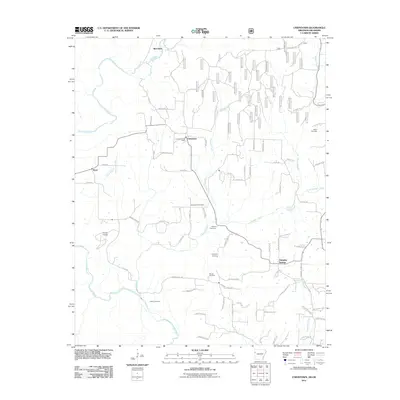
2011 Map of Uniontown
USGS Topo · Published 2011About this map
Uniontown and the surrounding Crawford County highlands are defined by a network of creeks and ridge-top settlements in this 2011 survey. The Uniontown Post Office serves as a central landmark for a community characterized by its many family and community burial grounds, including Macedonia Cemetery, Spears Cemetery, and Woods Cemetery. The terrain is deeply carved by water, with Lee Creek winding through the western portion of the map while Sulphur Creek and Webber Creek drain the central valleys. Modern developments like Strang Airpark and Shiloh Est sit alongside older nodes like Barcelona and Dripping Springs. A complex grid of forest roads and local lanes, such as Cherokee Hills Trl and Burchfiel Mountain Trl, illustrates the transition from rural residential areas to the more wooded, higher elevations near Angel Falls.
Find a feature on this map
73 named features on this map. Tap any name to fly to it.
Don’t see what you’re looking for? This feature index may not catch every label — zoom into the map to look around manually.
Map Details
Editions of this 2011 Uniontown Map
This is the sole edition of this map. No revisions or reprints were ever made.
Other maps of this area

1879 · Fort Smith
USGS Topo · 1:62,500

1887 · Van Buren
USGS Topo · 1:62,500

1890 · Fort Smith
USGS Topo · 1:125,000

1898 · Winslow #3
USGS Topo · 1:62,500

1898 · Tahlequah
USGS Topo · 1:125,000

1898 · Winslow
USGS Topo · 1:125,000

1900 · Sallisaw
USGS Topo · 1:125,000

1901 · Winslow
USGS Topo · 1:125,000

1901 · Tahlequah
USGS Topo · 1:125,000

1905 · Tahlequah
USGS Topo · 1:125,000