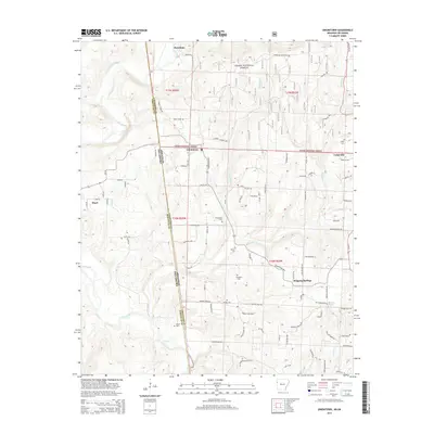
2014 Map of Uniontown
USGS Topo · Published 2014About this map
The Arkansas-Oklahoma state line bisects this landscape where the rugged terrain of the Ozark National Forest meets the valley of Lee Creek. In the early 21st century, this borderland remains defined by small settlements and a network of rural roads such as Uniontown Hwy and Philadelphia Rd. The topography is marked by several small cemeteries that serve as vital markers for local genealogy, including Salem Cem and Macedonia Cem near the central community of Uniontown. Waterways like Webber Cr and Sulphur Cr cut through the ridges, dictating the placement of older homesites and crossings. The map reveals a transition from the forested highlands in the north, including Barcelona, to the more settled areas of Cedarville and Dripping Springs in the southeast, providing a clear picture of the region's enduring rural character.
Find a feature on this map
49 named features on this map. Tap any name to fly to it.
Don’t see what you’re looking for? This feature index may not catch every label — zoom into the map to look around manually.
Map Details
Editions of this 2014 Uniontown Map
This is the sole edition of this map. No revisions or reprints were ever made.
Other maps of this area

1879 · Fort Smith
USGS Topo · 1:62,500

1887 · Van Buren
USGS Topo · 1:62,500

1890 · Fort Smith
USGS Topo · 1:125,000

1898 · Winslow #3
USGS Topo · 1:62,500

1898 · Tahlequah
USGS Topo · 1:125,000

1898 · Winslow
USGS Topo · 1:125,000

1900 · Sallisaw
USGS Topo · 1:125,000

1901 · Winslow
USGS Topo · 1:125,000

1901 · Tahlequah
USGS Topo · 1:125,000

1905 · Tahlequah
USGS Topo · 1:125,000