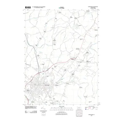
2010 Map of Uniontown
USGS Topo · Published 2010About this map
Uniontown serves as the central anchor of this 2010 topographic landscape, surrounded by a constellation of smaller industrial and residential settlements such as Lemont Furnace, Vances Mill, and Oliver. The map reveals a dense suburban and industrial network in the heart of Fayette County, where the topography rises sharply toward the east at Jumonville Rocks and Mount Independence. This transition from the urban valley floor to the ridgeline is marked by numerous watercourses, including Redstone Creek and Shutes Run, which carved the routes for early roads and settlement.
Find a feature on this map
126 named features on this map. Tap any name to fly to it.
Don’t see what you’re looking for? This feature index may not catch every label — zoom into the map to look around manually.
Map Details
Editions of this 2010 Uniontown Map
This is the sole edition of this map. No revisions or reprints were ever made.
Other maps of this area

1900 · Uniontown
USGS Topo · 1:62,500

1900 · Masontown
USGS Topo · 1:62,500

1902 · Brownsville
USGS Topo · 1:62,500

1902 · Connellsville
USGS Topo · 1:62,500

1903 · Masontown
USGS Topo · 1:62,500

1906 · Brownsville
USGS Topo · 1:62,500

1931 · Brownsville
USGS Topo · 1:62,500

1931 · Connellsville
USGS Topo · 1:62,500

1931 · Uniontown
USGS Topo · 1:62,500

1931 · Masontown
USGS Topo · 1:62,500
Featured Places
- Uniontown, PA
- North Union Township, PA
- Dunbar Township, PA
- Menallen Township, PA
- South Union Township, PA