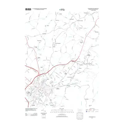
2013 Map of Uniontown
USGS Topo · Published 2013About this map
South Uniontown and East Uniontown serve as the urban anchor for this Fayette County landscape, where the foothills of the Laurel Highlands meet a dense network of industrial and residential settlements. The map illustrates a distinctive pattern of small communities such as Lemont Furnace, West Leisenring, and Mount Braddock, many of which developed around the region's historical coal and coke industries. These settlements are linked by a complex web of local roads like Connellsville RD and N Gallatin Ave Ext.
Find a feature on this map
108 named features on this map. Tap any name to fly to it.
Don’t see what you’re looking for? This feature index may not catch every label — zoom into the map to look around manually.
Map Details
Editions of this 2013 Uniontown Map
This is the sole edition of this map. No revisions or reprints were ever made.
Other maps of this area

1900 · Uniontown
USGS Topo · 1:62,500

1900 · Masontown
USGS Topo · 1:62,500

1902 · Brownsville
USGS Topo · 1:62,500

1902 · Connellsville
USGS Topo · 1:62,500

1903 · Masontown
USGS Topo · 1:62,500

1906 · Brownsville
USGS Topo · 1:62,500

1931 · Brownsville
USGS Topo · 1:62,500

1931 · Connellsville
USGS Topo · 1:62,500

1931 · Uniontown
USGS Topo · 1:62,500

1931 · Masontown
USGS Topo · 1:62,500
Featured Places
- Uniontown, PA
- North Union Township, PA
- Dunbar Township, PA
- Menallen Township, PA
- South Union Township, PA