
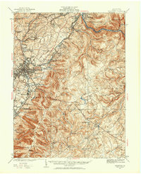
1931 Map of Uniontown
USGS Topo · Published 1956About this map
The industrial and colonial history of Fayette County converge at Uniontown, where the National Pike serves as a primary artery through the landscape. This 1931 revision highlights a complex rail network dominated by the Pennsylvania RR and Baltimore and Ohio RR, which serviced numerous industrial sites including the Dupont Powder Plant and the Lemont Furnace Darent Sta. The map provides significant genealogical value through its many rural schoolhouses, such as Hughes Sch and Sugar Run Sch, and cemeteries like Sylvan Heights Cem.
Find a feature on this map
156 named features on this map. Tap any name to fly to it.
Don’t see what you’re looking for? This feature index may not catch every label — zoom into the map to look around manually.
Map Details
Editions of this 1931 Uniontown Map
2 editions found
Other maps of this area

1900 · Accident
USGS Topo · 1:62,500

1900 · Uniontown
USGS Topo · 1:62,500

1900 · Masontown
USGS Topo · 1:62,500

1902 · Brownsville
USGS Topo · 1:62,500

1902 · Morgantown
USGS Topo · 1:62,500

1902 · Connellsville
USGS Topo · 1:62,500

1903 · Masontown
USGS Topo · 1:62,500

1904 · Bruceton
USGS Topo · 1:62,500

1906 · Brownsville
USGS Topo · 1:62,500

1922 · Confluence
USGS Topo · 1:62,500
Featured Places
- Uniontown, PA
- South Connellsville, PA
- Dunbar, PA
- Farmington, Wharton Township
- Chalkhill, Wharton Township