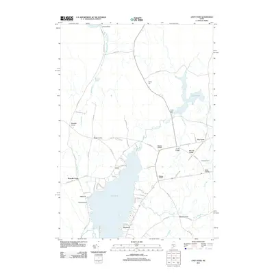
2011 Map of Unity Pond
USGS Topo · Published 2011About this map
Unity Pond dominates the southern landscape of this central Maine region, serving as a focal point for the lakeside communities of Oakwood and Windemere. The map reveals a high density of named crossroads that define the local social geography, including Smarts Corner, Cooks Corner, and Mitchell Corner, which likely evolved around family farms and rural commerce. To the north, the Sebasticook River flows past Peltoma Bridge, while Carlton Pond is controlled by the Carlton Pond Dam, feeding into Carlton Stream. Genealogists will find significant value in the distribution of burial sites across the townships, such as Chandler Cemetery near the western shore of the pond and Fairview Cemetery further east near Hales Corner. This network of brooks, including Beartrap Brook and Bithers Brook, illustrates the complex drainage system feeding into the larger water bodies that have historically supported the area's agriculture and early industry.
Find a feature on this map
72 named features on this map. Tap any name to fly to it.
Don’t see what you’re looking for? This feature index may not catch every label — zoom into the map to look around manually.
Map Details
Editions of this 2011 Unity Pond Map
This is the sole edition of this map. No revisions or reprints were ever made.
Other maps of this area

1926 · Burnham
USGS Topo · 1:62,500

1930 · Pittsfield
USGS Topo · 1:48,000

1931 · Stetson
USGS Topo · 1:48,000

1932 · Brooks
USGS Topo · 1:62,500

1932 · Pittsfield
USGS Topo · 1:62,500

1933 · Pittsfield
USGS Topo · 1:62,500

1935 · Stetson
USGS Topo · 1:62,500

1948 · Bangor
USGS Topo · 1:250,000

1955 · Pittsfield
USGS Topo · 1:62,500

1955 · Brooks
USGS Topo · 1:62,500