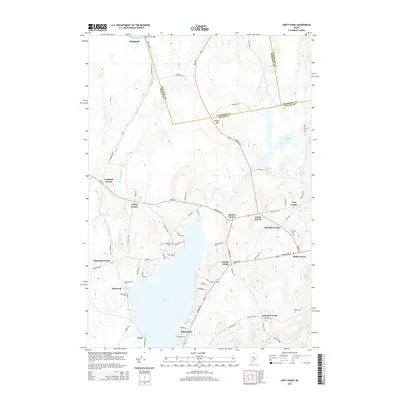
2014 Map of Unity Pond
USGS Topo · Published 2014About this map
Unity Pond dominates this central Maine landscape, serving as a focal point for the surrounding rural communities. The map details a web of family-named corners and settlements, from the northern reach of Pittsfield near the Sebasticook River to the village of Unity at the southern edge. The terrain is marked by distinct elevations such as Beech Hill, which stands between the pond and the wetlands of Carlton Pond.
Find a feature on this map
74 named features on this map. Tap any name to fly to it.
Don’t see what you’re looking for? This feature index may not catch every label — zoom into the map to look around manually.
Map Details
Editions of this 2014 Unity Pond Map
This is the sole edition of this map. No revisions or reprints were ever made.
Other maps of this area

1926 · Burnham
USGS Topo · 1:62,500

1930 · Pittsfield
USGS Topo · 1:48,000

1931 · Stetson
USGS Topo · 1:48,000

1932 · Brooks
USGS Topo · 1:62,500

1932 · Pittsfield
USGS Topo · 1:62,500

1933 · Pittsfield
USGS Topo · 1:62,500

1935 · Stetson
USGS Topo · 1:62,500

1948 · Bangor
USGS Topo · 1:250,000

1955 · Pittsfield
USGS Topo · 1:62,500

1955 · Brooks
USGS Topo · 1:62,500