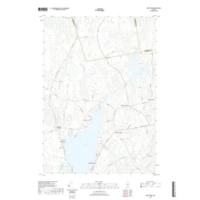
2018 Map of Unity Pond
USGS Topo · Published 2018About this map
Unity Pond dominates the southern landscape of this central Maine quadrangle, where the borders of Somerset, Waldo, and Penobscot counties converge. The terrain is defined by low-lying wetlands and intricate water systems, including the expansive Chain Meadows and the winding course of Carlton Stream which feeds into Carlton Pond. Small settlements and historic crossroads are scattered throughout the region, reflecting a rural community structure established around family-named landmarks and local intersections such as Greens Corner and Reynolds Corner.
Find a feature on this map
69 named features on this map. Tap any name to fly to it.
Don’t see what you’re looking for? This feature index may not catch every label — zoom into the map to look around manually.
Map Details
Editions of this 2018 Unity Pond Map
This is the sole edition of this map. No revisions or reprints were ever made.
Other maps of this area

1926 · Burnham
USGS Topo · 1:62,500

1930 · Pittsfield
USGS Topo · 1:48,000

1931 · Stetson
USGS Topo · 1:48,000

1932 · Brooks
USGS Topo · 1:62,500

1932 · Pittsfield
USGS Topo · 1:62,500

1933 · Pittsfield
USGS Topo · 1:62,500

1935 · Stetson
USGS Topo · 1:62,500

1948 · Bangor
USGS Topo · 1:250,000

1955 · Pittsfield
USGS Topo · 1:62,500

1955 · Brooks
USGS Topo · 1:62,500