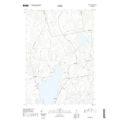
2021 Map of Unity Pond
USGS Topo · Published 2021About this map
Unity Pond dominates the southern landscape of this Maine quadrangle, where the borders of Somerset, Penobscot, and Waldo counties converge. The surrounding terrain is defined by a network of wetlands and water bodies, including Carlton Pond, Carlton Bog, and the winding Twentyfive Mile Stream. Small rural settlements like Troy Center, Windemere, and Greens Corner are connected by historical routes such as Bangor Rd and Troy Rd. Genealogists will find several family and community burial grounds documented across the area, including Fairview Cem near the eastern edge and Reynolds Cem closer to the western shore. The map illustrates a classic New England interior, where upland features like Beech Hill overlook vast meadows and marshes such as Chain Meadows, illustrating the enduring agricultural and natural character of the region.
Find a feature on this map
69 named features on this map. Tap any name to fly to it.
Don’t see what you’re looking for? This feature index may not catch every label — zoom into the map to look around manually.
Map Details
Editions of this 2021 Unity Pond Map
This is the sole edition of this map. No revisions or reprints were ever made.
Other maps of this area

1926 · Burnham
USGS Topo · 1:62,500

1930 · Pittsfield
USGS Topo · 1:48,000

1931 · Stetson
USGS Topo · 1:48,000

1932 · Brooks
USGS Topo · 1:62,500

1932 · Pittsfield
USGS Topo · 1:62,500

1933 · Pittsfield
USGS Topo · 1:62,500

1935 · Stetson
USGS Topo · 1:62,500

1948 · Bangor
USGS Topo · 1:250,000

1955 · Pittsfield
USGS Topo · 1:62,500

1955 · Brooks
USGS Topo · 1:62,500