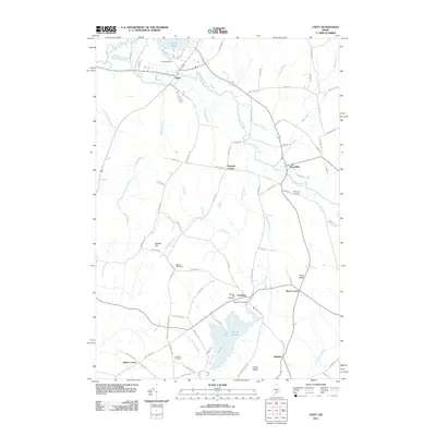
2011 Map of Unity
USGS Topo · Published 2011About this map
Unity sits at a geographic crossroads in this 21st-century landscape, where the Belfast & Moosehead Lake RR cuts through the northern reach of the township near Unity Pond. The terrain is defined by a dense network of streams including Twentyfive Mile Stream and Sandy Stream, which feed into Sandy Pond near the village of Freedom. This area of Waldo County maintains its rural character through established settlements like Farwells Corner, Thorndike, and Knox Corner. Genealogists will find a wealth of burial sites across the region, from the Pond Cemetery near the northern shore to Danforth Cemetery and Saywood Cemetery. The map documents the persistent agricultural and small-town infrastructure of the early 2000s, including the Unity Raceway and the Sandy Pond Dam, providing a clear view of the land before further modern development.
Find a feature on this map
94 named features on this map. Tap any name to fly to it.
Don’t see what you’re looking for? This feature index may not catch every label — zoom into the map to look around manually.
Map Details
Editions of this 2011 Unity Map
This is the sole edition of this map. No revisions or reprints were ever made.
Other maps of this area

1915 · Belfast
USGS Topo · 1:62,500

1916 · Liberty
USGS Topo · 1:62,500

1917 · Belfast
USGS Topo · 1:62,500

1926 · Burnham
USGS Topo · 1:62,500

1932 · Brooks
USGS Topo · 1:62,500

1941 · Belfast
USGS Topo · 1:62,500

1942 · Liberty
USGS Topo · 1:62,500

1948 · Bangor
USGS Topo · 1:250,000

1950 · Belfast
USGS Topo · 1:50,000

1950 · Liberty
USGS Topo · 1:50,000