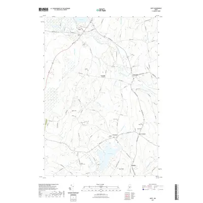
2021 Map of Unity
USGS Topo · Published 2021About this map
Unity College serves as a central landmark in this Waldo County landscape, situated just south of the village of Unity. The terrain is defined by the winding course of Sandy Stream and Halfmoon Stream, which flow through a region of low ridges and significant wetlands like Kähkökölus Bog. Local history is deeply embedded in the numerous family and community burial grounds scattered across the townships, including the Quaker Hill Cem and the Kelley - Danforth Cem. Small settlements such as Thorndike, Freedom, and Knox Corner are connected by a network of rural roads that follow the natural topography. The inclusion of Unity Raceway near the northern edge of the map highlights a long-standing local recreational tradition, while the area around Sandy Pond and Goose Ridge remains relatively undeveloped, reflecting the interior Maine character of the early 21st century.
Find a feature on this map
93 named features on this map. Tap any name to fly to it.
Don’t see what you’re looking for? This feature index may not catch every label — zoom into the map to look around manually.
Map Details
Editions of this 2021 Unity Map
This is the sole edition of this map. No revisions or reprints were ever made.
Other maps of this area

1915 · Belfast
USGS Topo · 1:62,500

1916 · Liberty
USGS Topo · 1:62,500

1917 · Belfast
USGS Topo · 1:62,500

1926 · Burnham
USGS Topo · 1:62,500

1932 · Brooks
USGS Topo · 1:62,500

1941 · Belfast
USGS Topo · 1:62,500

1942 · Liberty
USGS Topo · 1:62,500

1948 · Bangor
USGS Topo · 1:250,000

1950 · Belfast
USGS Topo · 1:50,000

1950 · Liberty
USGS Topo · 1:50,000