
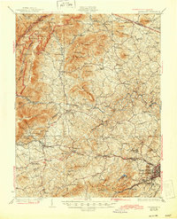
1931 Map of University
USGS Topo · Published 1931About this map
University of Virginia anchors the southeastern corner of this landscape, just as the early 20th-century transportation network began to reshape the Piedmont and Blue Ridge foothills. The Chesapeake And Ohio railroad and the Chesapeake And Ohio Highway No 39 provide a primary corridor through Crozet and Hillsboro (Yancey Mills PO), while the western ridges are traced by the Appalachian Trail.
Find a feature on this map
115 named features on this map. Tap any name to fly to it.
Don’t see what you’re looking for? This feature index may not catch every label — zoom into the map to look around manually.
Map Details
Editions of this 1931 University Map
2 editions found
Other maps of this area

1891 · Palmyra
USGS Topo · 1:125,000

1892 · Buckingham
USGS Topo · 1:125,000

1892 · Gordonsville
USGS Topo · 1:125,000

1892 · Harrisonburg
USGS Topo · 1:125,000

1895 · Palmyra
USGS Topo · 1:125,000

1897 · Palmyra
USGS Topo · 1:125,000

1929 · Covesville
USGS Topo · 1:62,500

1930 · Madison
USGS Topo · 1:48,000

1933 · Madison
USGS Topo · 1:62,500

1934 · Waynesboro
USGS Topo · 1:48,000