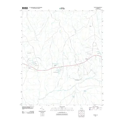
2011 Map of Upatoi
USGS Topo · Published 2011About this map
Upatoi Creek and its many tributaries, including the Tar River and Kendall Creek, dominate this West Georgia landscape as it appeared in the early 21st century. The map centers on the small unincorporated communities of Upatoi and Box Springs, capturing the residential clusters and essential infrastructure of the era, such as the Box Springs Post Office. This survey records a transition from agricultural roots to a modern rural-residential character, preserved through landmarks like Kings Millpond and several family-named burial grounds including Hollis Cemetery and Phillips Cemetery. Water management is a visible priority across the terrain, evidenced by numerous named reservoirs like Cox Lake, McClure Lake, and Montarella Lake, each held by a corresponding dam. The network of county roads, such as Patterson Rd and Cartledge Rd, links these scattered settlements and water bodies, revealing the established property boundaries and local travel patterns of Muscogee County.
Find a feature on this map
48 named features on this map. Tap any name to fly to it.
Don’t see what you’re looking for? This feature index may not catch every label — zoom into the map to look around manually.
Map Details
Editions of this 2011 Upatoi Map
This is the sole edition of this map. No revisions or reprints were ever made.
Other maps of this area

1907 · Talbotton
USGS Topo · 1:125,000

1908 · Columbus
USGS Topo · 1:62,500

1929 · Columbus
USGS Topo · 1:48,000

1947 · Columbus
USGS Topo · 1:62,500

1949 · Midland
USGS Topo · 1:24,000

1949 · Upatoi
USGS Topo · 1:24,000

1949 · Ochillee
USGS Topo · 1:24,000

1949 · Buena Vista NW
USGS Topo · 1:24,000

1950 · Talbotton
USGS Topo · 1:24,000

1950 · Geneva
USGS Topo · 1:24,000