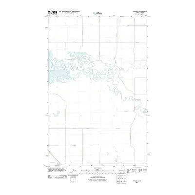
2011 Map of Upham SE
USGS Topo · Published 2011About this map
The Souris River meanders through this portion of McHenry County, its complex oxbows and channels creating a distinct riparian corridor. This 2011 survey highlights the river's path as it winds eastward, joined by Willow Creek in the central part of the quadrangle. Significant crossings such as Hillman Bridge and Johnson Bridge serve as critical links for the grid of section roads that define the rural landscape. Most of the terrain is organized by numbered routes like 77th St NE and Center Ave N, reflecting the precision of modern agricultural land division. In the southwestern corner, County Hwy-17 provides a primary transit link through the prairie, cutting diagonally across the established section lines.
Find a feature on this map
24 named features on this map. Tap any name to fly to it.
Don’t see what you’re looking for? This feature index may not catch every label — zoom into the map to look around manually.
Map Details
Editions of this 2011 Upham SE Map
This is the sole edition of this map. No revisions or reprints were ever made.
Other maps of this area

1949 · Kramer
USGS Topo · 1:24,000

1949 · Bantry
USGS Topo · 1:24,000

1950 · Kramer
USGS Topo · 1:24,000

1950 · Towner NW
USGS Topo · 1:24,000

1950 · Upham SE
USGS Topo · 1:24,000

1950 · Upham
USGS Topo · 1:24,000

1950 · Willow City SW
USGS Topo · 1:24,000

1950 · Bantry NW
USGS Topo · 1:24,000

1950 · Bantry
USGS Topo · 1:24,000

1954 · Gardena
USGS Topo · 1:24,000