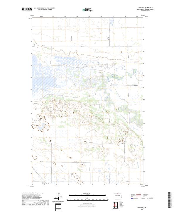
2024 Map of Upham SE
USGS Topo · Published 2024About this map
J. Clark Salyer National Wildlife Refuge dominates this landscape in McHenry County, where the meandering course of the Souris River creates a complex network of wetlands and oxbows. The river's winding path through the prairie is joined from the east by Willow Creek, forming a critical riparian corridor in the North Dakota plains. The survey illustrates a highly structured grid of section lines and rural roads, such as 83rd St NE and 75th St N, which overlay the natural hydrology. This intersection of a strictly surveyed township-and-range system with the fluid, shifting banks of the Souris demonstrates the 21st-century management of public conservation lands alongside established agricultural corridors like Co Hwy 17.
Find a feature on this map
23 named features on this map. Tap any name to fly to it.
Don’t see what you’re looking for? This feature index may not catch every label — zoom into the map to look around manually.
Map Details
Editions of this 2024 Upham SE Map
This is the sole edition of this map. No revisions or reprints were ever made.
Other maps of this area

1949 · Kramer
USGS Topo · 1:24,000

1949 · Bantry
USGS Topo · 1:24,000

1950 · Kramer
USGS Topo · 1:24,000

1950 · Towner NW
USGS Topo · 1:24,000

1950 · Upham SE
USGS Topo · 1:24,000

1950 · Upham
USGS Topo · 1:24,000

1950 · Willow City SW
USGS Topo · 1:24,000

1950 · Bantry NW
USGS Topo · 1:24,000

1950 · Bantry
USGS Topo · 1:24,000

1954 · Gardena
USGS Topo · 1:24,000