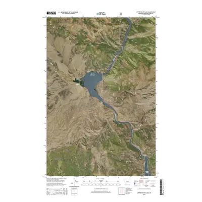
2014 Map of Upper Holter Lake
USGS Topo · Published 2014About this map
The Missouri River cuts a winding path through this portion of the Helena National Forest, creating a landscape defined by dramatic elevation changes and significant water bodies. The river's course is punctuated by Upper Holter Lake and the northern reach of Hauser Lake, where the Black Sandy Beach provides a distinct landmark along the shoreline. This area is characterized by steep drainage systems and prominent peaks, including Sacajawea Mtn and Stony Point, which overlook a series of deep canyons such as Meriwether Canyon and Coulter Canyon.
Find a feature on this map
34 named features on this map. Tap any name to fly to it.
Don’t see what you’re looking for? This feature index may not catch every label — zoom into the map to look around manually.
Map Details
Editions of this 2014 Upper Holter Lake Map
This is the sole edition of this map. No revisions or reprints were ever made.
Other maps of this area

1886 · Fort Logan
USGS Topo · 1:250,000

1889 · Helena
USGS Topo · 1:250,000

1893 · Helena
USGS Topo · 1:250,000

1899 · Helena
USGS Topo · 1:62,500

1899 · Helena
USGS Topo · 1:250,000

1903 · Helena
USGS Topo · 1:250,000

1947 · Butte
USGS Topo · 1:250,000

1948 · White Sulphur Springs
USGS Topo · 1:250,000

1950 · East Helena
USGS Topo · 1:62,500

1950 · Helena
USGS Topo · 1:62,500