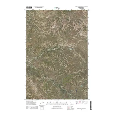
2014 Map of Upper Magpie Reservoir
USGS Topo · Published 2014About this map
Gas City Oil Field and the North Pine Oil Field define the industrial footprint of this portion of Dawson County, where energy extraction meets the high plains drainage systems. The landscape is carved by numerous seasonal waterways, most notably Magpie Creek, which feeds into the Upper Magpie Reservoir. Further south, the terrain supports additional water management features including Forks Reservoir and Camp Reservoir, both situated along the winding course of Cedar Creek. Rural transit across these sections is maintained by a network of local routes such as Marsh Rd and Road 114. This survey illustrates the spatial relationship between natural creek beds like Forbill Creek and Sand Creek and the township-range boundaries that organize the Montana ranch and oil lands.
Find a feature on this map
16 named features on this map. Tap any name to fly to it.
Don’t see what you’re looking for? This feature index may not catch every label — zoom into the map to look around manually.
Map Details
Editions of this 2014 Upper Magpie Reservoir Map
This is the sole edition of this map. No revisions or reprints were ever made.
Other maps of this area

1909 · Glendive
USGS Topo · 1:250,000

1953 · Miles City
USGS Topo · 1:250,000

1954 · Glendive
USGS Topo · 1:250,000

1957 · Miles City
USGS Topo · 1:250,000

1957 · Glendive
USGS Topo · 1:250,000

1958 · Miles City
USGS Topo · 1:250,000

1958 · Glendive
USGS Topo · 1:250,000
1967 · Allard
USGS Topo · 1:24,000
1967 · Hoyt
USGS Topo · 1:24,000
1967 · Glendive
USGS Topo · 1:24,000