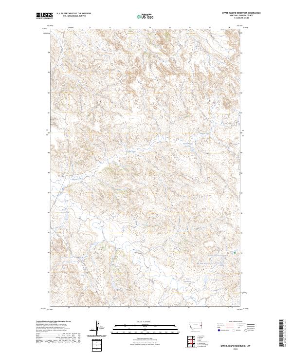
2024 Map of Upper Magpie Reservoir
USGS Topo · Published 2024About this map
Magpie Creek and its seasonal tributaries define this stretch of Dawson County, where the high plains landscape is managed through a complex network of small reservoirs and stock ponds. These water management features, including the central Upper Magpie Reservoir and the more remote Prairie Goat Reservoir, illustrate the critical infrastructure required for ranching in this arid region. The drainage patterns of Abbot Draw and Cedar Creek move through a series of collection points like Big Drop Reservoir and Bailer Reservoir, showing how every contour is utilized to capture runoff. Located within the Public Land Survey System townships of T14N R56E and T13N R55E, the map details a land of vast open sections sparsely connected by local routes like Fas 335 and RD 100.
Find a feature on this map
17 named features on this map. Tap any name to fly to it.
Don’t see what you’re looking for? This feature index may not catch every label — zoom into the map to look around manually.
Map Details
Editions of this 2024 Upper Magpie Reservoir Map
This is the sole edition of this map. No revisions or reprints were ever made.
Other maps of this area

1909 · Glendive
USGS Topo · 1:250,000

1953 · Miles City
USGS Topo · 1:250,000

1954 · Glendive
USGS Topo · 1:250,000

1957 · Miles City
USGS Topo · 1:250,000

1957 · Glendive
USGS Topo · 1:250,000

1958 · Miles City
USGS Topo · 1:250,000

1958 · Glendive
USGS Topo · 1:250,000

1967 · Allard
USGS Topo · 1:24,000

1967 · Hoyt
USGS Topo · 1:24,000
1967 · Glendive
USGS Topo · 1:24,000