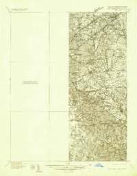
1934 Map of Upper Marlboro (east half)
USGS Topo · Published 1934About this map
Upper Marlboro Road and Pennsylvania Avenue serve as the primary conduits through this Prince George's County landscape, connecting numerous small communities and rural election districts during the mid-1930s. The survey reveals a shifting transportation network, most notably marking the Pennsylvania RR (Abandoned) alongside the active Chesapeake Beach RR. Settlements like Glenarden, Seabrook, and Forestville are depicted at a time when the region was primarily agricultural, defined by sprawling boundaries such as Queen Anne No 7 and Mellwood No 15.
Find a feature on this map
62 named features on this map. Tap any name to fly to it.
Don’t see what you’re looking for? This feature index may not catch every label — zoom into the map to look around manually.
Map Details
Editions of this 1934 Upper Marlboro (east half) Map
2 editions found
Other maps of this area

1890 · Mt. Vernon
USGS Topo · 1:125,000

1891 · Mt. Vernon
USGS Topo · 1:125,000

1892 · Laurel
USGS Topo · 1:62,500

1892 · Prince Frederick
USGS Topo · 1:62,500

1892 · Brandywine
USGS Topo · 1:62,500

1892 · Owensville
USGS Topo · 1:62,500

1893 · Frederick
USGS Topo · 1:125,000

1894 · Laurel
USGS Topo · 1:62,500

1894 · Frederick
USGS Topo · 1:125,000

1894 · Relay
USGS Topo · 1:62,500