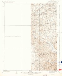
1937 Map of Upper Marlboro
USGS Topo · Published 1937About this map
Upper Marlboro and the surrounding Prince George’s County landscape appear here in a state of transition during the mid-1930s. The region is defined by its rural schoolhouses and historic congregations, including the Westphalia Sch and Holy Trinity Ch. Transport corridors dictate the layout of the land, with the Pennsylvania and W B and A railroads providing critical links for settlements like Glenn Dale, Seabrook, and Lanham.
Find a feature on this map
62 named features on this map. Tap any name to fly to it.
Don’t see what you’re looking for? This feature index may not catch every label — zoom into the map to look around manually.
Map Details
Editions of this 1937 Upper Marlboro Map
This is the sole edition of this map. No revisions or reprints were ever made.
Other maps of this area

1890 · Mt. Vernon
USGS Topo · 1:125,000

1891 · Mt. Vernon
USGS Topo · 1:125,000

1892 · Laurel
USGS Topo · 1:62,500

1892 · Prince Frederick
USGS Topo · 1:62,500

1892 · Brandywine
USGS Topo · 1:62,500

1892 · Owensville
USGS Topo · 1:62,500

1893 · Frederick
USGS Topo · 1:125,000

1894 · Laurel
USGS Topo · 1:62,500

1894 · Frederick
USGS Topo · 1:125,000

1894 · Relay
USGS Topo · 1:62,500