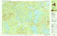
1979 Map of Upper Saranac Lake
USGS Topo · Published 1979About this map
Saranac Inn serves as a primary landing on the northern shores of the lake, reflecting the late 1970s character of this Adirondack Park interior. The landscape is a complex mosaic of water and timber, dominated by the sprawling reaches of Upper Saranac Lake and its many named islands, including Buck Island and Eagle Island. Small settlements like Derrick and Floodwood appear alongside evidence of changing transportation, most notably the Old Railroad Grade winding through the western woods near Floodwood Mountain.
Find a feature on this map
114 named features on this map. Tap any name to fly to it.
Don’t see what you’re looking for? This feature index may not catch every label — zoom into the map to look around manually.
Map Details
Editions of this 1979 Upper Saranac Lake Map
This is the sole edition of this map. No revisions or reprints were ever made.
Other maps of this area

1902 · Saranac
USGS Topo · 1:62,500

1904 · Saranac
USGS Topo · 1:62,500

1904 · Santanoni
USGS Topo · 1:62,500

1904 · Long Lake
USGS Topo · 1:62,500

1905 · Saint Regis
USGS Topo · 1:62,500

1907 · Tupper Lake
USGS Topo · 1:62,500

1920 · Childwold
USGS Topo · 1:62,500

1921 · Childwold
USGS Topo · 1:48,000

1922 · Childwold
USGS Topo · 1:62,500

1948 · Ogdensburg
USGS Topo · 1:250,000