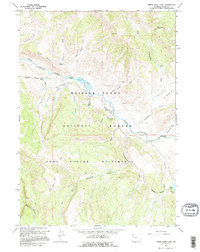
1965 Map of Upper Slide Lake
USGS Topo · Published 1995About this map
Gros Ventre River drainage dominates this high-elevation mountain terrain as it appeared during a 1965 field check. The landscape is defined by its hydrology and early resource management, centered on the Goosewing Guard Sta and the prominent Upper Slide Lake. This area of the Bridger-Teton National Forest shows a reliance on primitive transportation, with a network of Pack Trails and 4wd tracks connecting remote points like Gunsight Pass and Yellowjacket Flat. To the south, the Gros Ventre Wilderness boundary separates the managed forest from the more secluded reaches of Goosewing Creek and Two Echo Park Creek. The presence of Coal Mine Draw suggests a history of small-scale mineral extraction, while named water bodies like Dallas Lake and Soda Lake indicate a complex network of alpine basins.
Find a feature on this map
35 named features on this map. Tap any name to fly to it.
Don’t see what you’re looking for? This feature index may not catch every label — zoom into the map to look around manually.
Map Details
Editions of this 1965 Upper Slide Lake Map
2 editions found
Other maps of this area

1902 · Mt Leidy
USGS Topo · 1:125,000

1907 · Gros Ventre
USGS Topo · 1:125,000

1910 · Gros Ventre
USGS Topo · 1:125,000

1955 · Driggs
USGS Topo · 1:250,000

1958 · Driggs
USGS Topo · 1:250,000

1962 · Driggs
USGS Topo · 1:250,000

1965 · Green Mountain
USGS Topo · 1:24,000

1965 · Mount Leidy
USGS Topo · 1:24,000
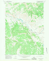
1965 · Upper Slide Lake
USGS Topo · 1:24,000

1965 · Tripod Peak
USGS Topo · 1:24,000