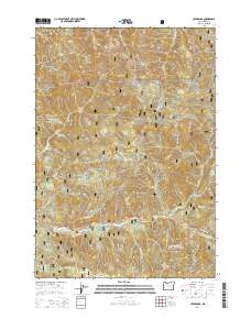
2014 Map of Upper Soda
USGS Topo · Published 2014About this map
Upper Soda serves as a central reference point in this portion of the Willamette National Forest, where the S Santiam River carves through the southern landscape of the Cascade Range. This 2014 survey documents the convergence of historical and modern transit, featuring the Old Santiam Wagon Rd running parallel to the Santiam Hwy. The map provides a detailed look at the drainage systems of the region, including Soda Fork, Trout Cr, and Moose Cr. Landform nomenclature is prominent throughout, with high points such as Moose Mtn, Cougar Rock, and the strikingly named Bloody Point punctuating the ridges. The distribution of National Forest Development Roads illustrates the 21st-century management of these timberlands, while names like Moose Lake and Rooster Rock anchor the local geography for those researching Linn County history.
Find a feature on this map
74 named features on this map. Tap any name to fly to it.
Don’t see what you’re looking for? This feature index may not catch every label — zoom into the map to look around manually.
Map Details
Editions of this 2014 Upper Soda Map
This is the sole edition of this map. No revisions or reprints were ever made.
Other maps of this area
1929 · Mill City
USGS Topo · 1:125,000
1934 · Mc Kenzie Bridge
USGS Topo · 1:96,000
1940 · Mc Kenzie Bridge
USGS Topo · 1:125,000
1953 · Salem
USGS Topo · 1:250,000
1954 · Salem
USGS Topo · 1:250,000
1955 · Cascadia
USGS Topo · 1:62,500
1955 · Echo Mountain
USGS Topo · 1:62,500
1956 · Quartzville
USGS Topo · 1:62,500
1956 · Detroit
USGS Topo · 1:62,500
1960 · Salem
USGS Topo · 1:250,000