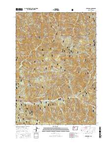
2017 Map of Upper Soda
USGS Topo · Published 2017About this map
The Santiam Wagon Road serves as a central artery through this portion of the Willamette National Forest, tracing the historic transportation corridor along the South Santiam River. In the settlement of Upper Soda, the landscape transitions from the river valley into the high elevations of the Cascade Range. This 2017 survey highlights the persistent legacy of 19th-century transit, showing the Old Santiam Wagon Rd winding through the terrain near modern forest infrastructure. To the south, Gordon Lakes and various mountain drainages like Trout Creek and Boulder Creek define the hydrology of the area. Distinctive landmarks such as Rooster Rock and Moose Mountain overlook a complex network of forest development roads, illustrating the modern management of these timberlands and their role in Oregon’s outdoor and industrial history.
Find a feature on this map
47 named features on this map. Tap any name to fly to it.
Don’t see what you’re looking for? This feature index may not catch every label — zoom into the map to look around manually.
Map Details
Editions of this 2017 Upper Soda Map
This is the sole edition of this map. No revisions or reprints were ever made.
Other maps of this area
1929 · Mill City
USGS Topo · 1:125,000
1934 · Mc Kenzie Bridge
USGS Topo · 1:96,000
1940 · Mc Kenzie Bridge
USGS Topo · 1:125,000
1953 · Salem
USGS Topo · 1:250,000
1954 · Salem
USGS Topo · 1:250,000
1955 · Cascadia
USGS Topo · 1:62,500
1955 · Echo Mountain
USGS Topo · 1:62,500
1956 · Quartzville
USGS Topo · 1:62,500
1956 · Detroit
USGS Topo · 1:62,500
1960 · Salem
USGS Topo · 1:250,000