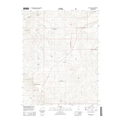
2014 Map of Upper Valley
USGS Topo · Published 2014About this map
Upper Valley sits within a complex geological corridor defined by the Escalante Mountains and the high elevations of the Table Cliff Plateau. This landscape is primarily managed as part of the Dixie National Forest, where the terrain drops from the northern meadows down through a series of dramatic canyons and washes. Water sources like Garden Spring and Willow Spring are critical nodes in this arid environment, supporting the drainages of Allen Cr and Henrieville Cr. The southern portion of the map reveals distinctive badlands known as The Blues, located near Paria Hollow. Transportation is anchored by State Rte 12, which winds through the center of the quadrangle, passing Liston Flat and providing access to the various hollows and canyons that characterize this part of Garfield County.
Find a feature on this map
45 named features on this map. Tap any name to fly to it.
Don’t see what you’re looking for? This feature index may not catch every label — zoom into the map to look around manually.
Map Details
Editions of this 2014 Upper Valley Map
This is the sole edition of this map. No revisions or reprints were ever made.
Other maps of this area
1886 · Escalante
USGS Topo · 1:250,000
1956 · Escalante
USGS Topo · 1:250,000
1960 · Escalante
USGS Topo · 1:250,000
1964 · Griffin Point
USGS Topo · 1:24,000
1964 · Canaan Creek
USGS Topo · 1:24,000
1964 · Canaan Peak
USGS Topo · 1:24,000
1964 · Death Ridge
USGS Topo · 1:24,000
1964 · Henrieville
USGS Topo · 1:24,000
1964 · Sweetwater Creek
USGS Topo · 1:24,000
1964 · Wide Hollow Reservoir
USGS Topo · 1:24,000