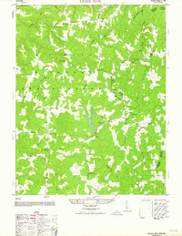
1964 Map of Upper Zion
USGS Topo · Published 1964About this map
The A P Hill Military Reservation dominates this mid-century landscape in Caroline County, showing the intersection of military land use and established rural Virginia life. Numerous small settlements and crossroads like Brandywine, Naulakla, and Goldmans Corner are scattered throughout the territory, often defined by their proximity to the network of numbered military roads. Local family and community roots are evident in the density of burial sites and houses of worship, including Eagles Nest Cemetery near Passing and the Ebenezer Baptist Church in the northeast. The geography is carved by Tobacco Run and Beverly Run, where traditional land markers like the Sycamore School and multiple unnamed ruins suggest a shifting pattern of habitation as the reservation's boundaries influenced the local architecture and road networks.
Find a feature on this map
44 named features on this map. Tap any name to fly to it.
Don’t see what you’re looking for? This feature index may not catch every label — zoom into the map to look around manually.
Map Details
Editions of this 1964 Upper Zion Map
This is the sole edition of this map. No revisions or reprints were ever made.
Other maps of this area

1889 · Fredericksburg
USGS Topo · 1:125,000

1892 · Fredericksburg
USGS Topo · 1:125,000

1894 · Fredericksburg
USGS Topo · 1:125,000

1918 · Doswell
USGS Topo · 1:62,500

1918 · Aylett
USGS Topo · 1:62,500

1933 · Aylett
USGS Topo · 1:62,500

1942 · Bowling Green
USGS Topo · 1:31,680

1942 · Upper Zion
USGS Topo · 1:31,680

1942 · Occupacia
USGS Topo · 1:31,680

1942 · Rollins Fork
USGS Topo · 1:31,680