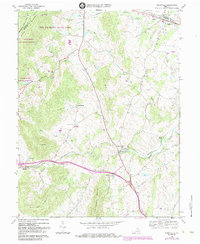
1970 Map of Upperville
USGS Topo · Published 1984About this map
Sky Meadows State Park and the Appalachian National Scenic Trail dominate the northern crests of the Blue Ridge in this survey of the Virginia Piedmont. The landscape transitions from the high ridges of G Richard Thompson State Wildlife Management Area down to the fertile valleys of the Southern railroad corridor. The map reveals a dense network of early rural congregations, including Pleasant Vale Ch, Cool Spring Ch, and Emmanuel Ch, which anchor the small crossroads communities.
Find a feature on this map
37 named features on this map. Tap any name to fly to it.
Don’t see what you’re looking for? This feature index may not catch every label — zoom into the map to look around manually.
Map Details
Editions of this 1970 Upperville Map
Other maps of this area

1884 · Harpers Ferry
USGS Topo · 1:125,000

1891 · Harpers Ferry
USGS Topo · 1:125,000

1893 · Luray
USGS Topo · 1:125,000

1893 · Harpers Ferry
USGS Topo · 1:125,000

1894 · Warrenton
USGS Topo · 1:125,000

1894 · Winchester
USGS Topo · 1:125,000

1905 · Luray
USGS Topo · 1:125,000

1916 · Berryville
USGS Topo · 1:62,500

1938 · Winchester
USGS Topo · 1:48,000

1939 · Front Royal
USGS Topo · 1:48,000