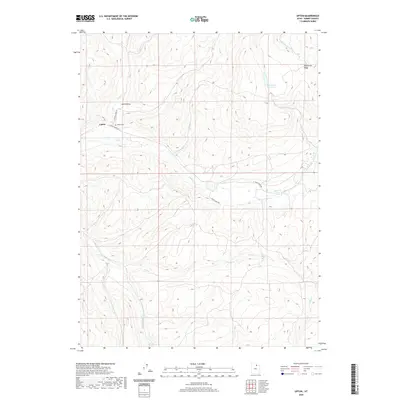
2020 Map of Upton
USGS Topo · Published 2020About this map
Upton sits at the convergence of several major drainages in this pocket of Summit County, where Huff Cr and Chalk Cr dictate the layout of local roads and settlement. The landscape is defined by its water systems, from the high Porcupine Reservoir and Porcupine Cr in the northeast to the S Fork Chalk Cr and Fish Cr winding through the southern reaches. Local genealogy and land use are centered near the Upton Cem, positioned just off E Chalk Creek Rd. The terrain reveals a transition from the lower valley floors to prominent features like Porcupine Ridge and the distinct depression of Josh Hollow. The road network, including N Huff Creek Rd and Mossy Oaks Rd, follows these natural corridors, reflecting a community shaped by its hydrology and high-country geography.
Find a feature on this map
15 named features on this map. Tap any name to fly to it.
Don’t see what you’re looking for? This feature index may not catch every label — zoom into the map to look around manually.
Map Details
Editions of this 2020 Upton Map
This is the sole edition of this map. No revisions or reprints were ever made.
Other maps of this area

1885 · Salt Lake
USGS Topo · 1:250,000

1900 · Coalville
USGS Topo · 1:125,000

1903 · Coalville
USGS Topo · 1:125,000

1954 · Salt Lake City
USGS Topo · 1:250,000

1954 · Ogden
USGS Topo · 1:250,000

1958 · Ogden
USGS Topo · 1:250,000

1958 · Salt Lake City
USGS Topo · 1:250,000

1960 · Ogden
USGS Topo · 1:250,000

1960 · Salt Lake City
USGS Topo · 1:250,000
1964 · Heiners Creek
USGS Topo · 1:24,000