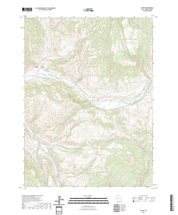
2023 Map of Upton
USGS Topo · Published 2023About this map
The settlement of Upton sits at the junction of Huff Creek and Chalk Creek, serving as a central point in this corner of Summit County. This 2023 survey illustrates a landscape defined by its riparian corridors and high terrain, notably Porcupine Ridge and the nearby Porcupine Reservoir in the northeast. The community's history is anchored by the Upton Cem, located just north of the town center along N Huff Creek Rd.
Find a feature on this map
14 named features on this map. Tap any name to fly to it.
Don’t see what you’re looking for? This feature index may not catch every label — zoom into the map to look around manually.
Map Details
Editions of this 2023 Upton Map
This is the sole edition of this map. No revisions or reprints were ever made.
Other maps of this area

1885 · Salt Lake
USGS Topo · 1:250,000

1900 · Coalville
USGS Topo · 1:125,000

1903 · Coalville
USGS Topo · 1:125,000

1954 · Salt Lake City
USGS Topo · 1:250,000

1954 · Ogden
USGS Topo · 1:250,000

1958 · Ogden
USGS Topo · 1:250,000

1958 · Salt Lake City
USGS Topo · 1:250,000

1960 · Ogden
USGS Topo · 1:250,000

1960 · Salt Lake City
USGS Topo · 1:250,000
1964 · Heiners Creek
USGS Topo · 1:24,000