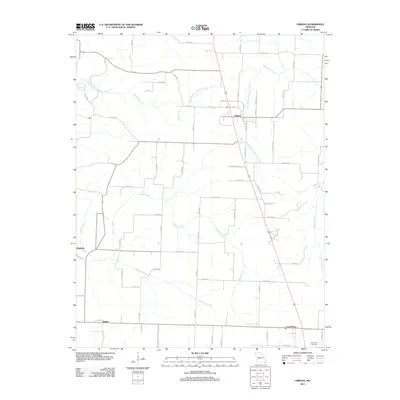
2011 Map of Urbana
USGS Topo · Published 2011About this map
Urbana and Louisburg anchor the north and south ends of this rural Missouri corridor in Dallas County. The settlement pattern here is dictated by a network of local county roads and a landscape carved by numerous waterways, including the West Branch Cahoochie Creek and East Branch Cahoochie Creek which converge near the northern border. Further west, the small communities of Huckaby and Rimby sit along the winding paths of Ingalls Creek and Wilkinson Creek. This 2011 survey reveals a region that maintains its agricultural character, with long-established landmarks like the Cunnington Cemetery providing a clear genealogical link for local families. The map provides a detailed view of the street grids in the larger towns, specifically highlighting local thoroughfares such as N Atlantic St and S Main St in Urbana.
Find a feature on this map
73 named features on this map. Tap any name to fly to it.
Don’t see what you’re looking for? This feature index may not catch every label — zoom into the map to look around manually.
Map Details
Editions of this 2011 Urbana Map
This is the sole edition of this map. No revisions or reprints were ever made.
Other maps of this area

1884 · Bolivar
USGS Topo · 1:125,000

1892 · Bolivar
USGS Topo · 1:125,000

1949 · Sentinel
USGS Topo · 1:24,000

1950 · Sentinel
USGS Topo · 1:24,000

1950 · Buffalo NW
USGS Topo · 1:24,000

1950 · Polk
USGS Topo · 1:24,000

1950 · Urbana
USGS Topo · 1:24,000

1951 · Buffalo NW
USGS Topo · 1:24,000

1951 · Urbana
USGS Topo · 1:24,000

1951 · Polk
USGS Topo · 1:24,000