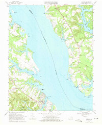
1968 Map of Urbanna
USGS Topo · Published 1971About this map
The Rappahannock River defines the landscape of this coastal Virginia region, separating Lancaster and Middlesex counties in the late 1960s. The town of Urbanna serves as a primary hub on the southern bank, characterized by its historical waterfront near Remlik Wharf and the Middlesex Memorial Cem. This survey illustrates the intricate tidal geography of the Northern Neck and Middle Peninsula, where numerous creeks like South Branch Lagrange Creek and Urbanna Creek create a deeply indented shoreline. Inland, the map reveals a pattern of dispersed rural communities and spiritual centers, such as St Marys White Chapel and Remlik Pilgrim Ch. The maritime and agricultural economy is evident through features like the Rosegill Farm Landing Strip and various Sandpits, while small landings and points like Bailey Pt and Towles Pt highlight the historical reliance on waterborne transport and local fisheries.
Find a feature on this map
70 named features on this map. Tap any name to fly to it.
Don’t see what you’re looking for? This feature index may not catch every label — zoom into the map to look around manually.
Map Details
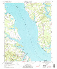
Editions of this 1968 Urbanna Map
2 editions found
Other maps of this area

1916 · Kilmarnock
USGS Topo · 1:48,000

1917 · Heathsville
USGS Topo · 1:48,000

1917 · Urbanna
USGS Topo · 1:62,500

1917 · Morattico
USGS Topo · 1:62,500

1917 · Kilmarnock
USGS Topo · 1:62,500

1918 · Morattico
USGS Topo · 1:62,500

1926 · Morattico
USGS Topo · 1:62,500

1942 · Kilmarnock
USGS Topo · 1:62,500

1943 · Richmond
USGS Topo · 1:250,000

1944 · Morattico
USGS Topo · 1:31,680