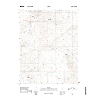
2018 Map of Ursine
USGS Topo · Published 2018About this map
Ursine and the surrounding high-desert valleys of Lincoln County are captured here in a period of modern ranching and rural settlement. The landscape is defined by the drainage systems of Meadow Valley Wash and Immigration Wash, which provide the hydrological basis for the scattered communities of Eagle Valley and Rose Valley. These settlements are tucked between prominent relief features like the Needle Mountains and numerous steep-walled cuts including Horsethief Canyon and Serviceberry Canyon.
Find a feature on this map
26 named features on this map. Tap any name to fly to it.
Don’t see what you’re looking for? This feature index may not catch every label — zoom into the map to look around manually.
Map Details
Editions of this 2018 Ursine Map
This is the sole edition of this map. No revisions or reprints were ever made.
Other maps of this area

1885 · Pioche
USGS Topo · 1:250,000

1886 · Pioche
USGS Topo · 1:250,000

1921 · NW 1/4 Panaca
USGS Topo · 1:48,000

1954 · Caliente
USGS Topo · 1:250,000

1956 · Lund
USGS Topo · 1:250,000

1959 · Caliente
USGS Topo · 1:250,000

1960 · Lund
USGS Topo · 1:250,000

1970 · Pierson Summit
USGS Topo · 1:24,000
1970 · Condor Canyon
USGS Topo · 1:24,000
1970 · Rose Valley
USGS Topo · 1:24,000