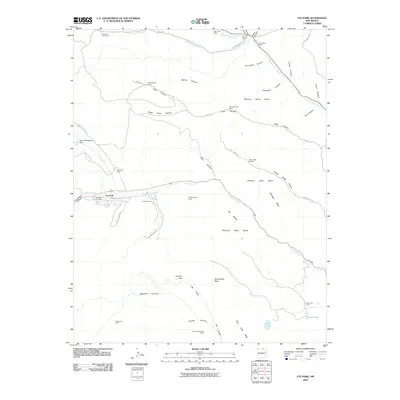
2010 Map of Ute Park
USGS Topo · Published 2010About this map
The Cimarron River winds through this northern New Mexico corridor, where the small community of Ute Park serves as a gateway to the high-country canyons. The landscape is defined by the extensive operations of the Philmont Scout Ranch, which maintains numerous remote outposts including Pueblano Trail Camp, Bents Camp, and Harlan Trail Camp. These camps are connected by a network of historic pathways like the Dean Trl and Turkey Creek Trl, which navigate the steep geography of Midnight Mesa and The Bench.
Find a feature on this map
54 named features on this map. Tap any name to fly to it.
Don’t see what you’re looking for? This feature index may not catch every label — zoom into the map to look around manually.
Map Details
Editions of this 2010 Ute Park Map
This is the sole edition of this map. No revisions or reprints were ever made.
Other maps of this area

1954 · Raton
USGS Topo · 1:250,000

1955 · Cimarron
USGS Topo · 1:62,500

1955 · Ute Park
USGS Topo · 1:62,500

1956 · Tooth Of Time
USGS Topo · 1:62,500

1956 · Miami
USGS Topo · 1:62,500

1958 · Raton
USGS Topo · 1:250,000

1981 · Springer
USGS Topo · 1:100,000

1981 · Raton
USGS Topo · 1:100,000

1982 · Wheeler Peak
USGS Topo · 1:100,000

1983 · Taos
USGS Topo · 1:100,000