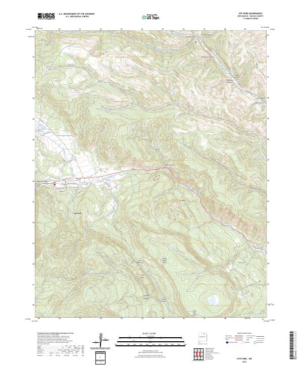
2023 Map of Ute Park
USGS Topo · Published 2023About this map
Ute Park serves as the central hub of this Colfax County landscape, situated where the Cimarron River cuts through the high canyons. The settlement pattern follows the river valley and the base of The Bench, with a modest network of local roads including Butler Rd and Hummingbird Ln branching off the main thoroughfare. The surrounding terrain is defined by a dense system of canyons and gulches, reflecting a history of timber and water management suggested by names like Sawmill Canyon and Ute Gulch.
Find a feature on this map
38 named features on this map. Tap any name to fly to it.
Don’t see what you’re looking for? This feature index may not catch every label — zoom into the map to look around manually.
Map Details
Editions of this 2023 Ute Park Map
This is the sole edition of this map. No revisions or reprints were ever made.
Other maps of this area

1954 · Raton
USGS Topo · 1:250,000

1955 · Cimarron
USGS Topo · 1:62,500

1955 · Ute Park
USGS Topo · 1:62,500

1956 · Tooth Of Time
USGS Topo · 1:62,500

1956 · Miami
USGS Topo · 1:62,500

1958 · Raton
USGS Topo · 1:250,000

1981 · Springer
USGS Topo · 1:100,000

1981 · Raton
USGS Topo · 1:100,000

1982 · Wheeler Peak
USGS Topo · 1:100,000

1983 · Taos
USGS Topo · 1:100,000