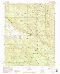
1987 Map of Ute Park
USGS Topo · Published 1987About this map
The Philmont Scout Ranch dominates this landscape in the late 1980s, revealing a dense network of backcountry camps and hiking trails within the Beaubien and Miranda Grant. The terrain is defined by deep canyons such as Dean Canyon and Spring Canyon, which lead down toward the Cimarron River. The settlement at Ute Park sits at the western edge of the grant, serving as a gateway to the high country.
Find a feature on this map
53 named features on this map. Tap any name to fly to it.
Don’t see what you’re looking for? This feature index may not catch every label — zoom into the map to look around manually.
Map Details
Editions of this 1987 Ute Park Map
This is the sole edition of this map. No revisions or reprints were ever made.
Other maps of this area

1954 · Raton
USGS Topo · 1:250,000

1955 · Cimarron
USGS Topo · 1:62,500

1955 · Ute Park
USGS Topo · 1:62,500

1956 · Tooth Of Time
USGS Topo · 1:62,500

1956 · Miami
USGS Topo · 1:62,500

1958 · Raton
USGS Topo · 1:250,000

1981 · Springer
USGS Topo · 1:100,000

1981 · Raton
USGS Topo · 1:100,000

1982 · Wheeler Peak
USGS Topo · 1:100,000

1983 · Taos
USGS Topo · 1:100,000