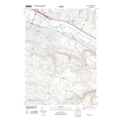
2011 Map of Utica East
USGS Topo · Published 2011About this map
The Mohawk River corridor anchors this portion of Utica, where the landscape transitions from the dense urban grid of the city's eastern edge into the rolling uplands of Oneida and Herkimer Counties. In the north, the industrial character of West Frankfort and Harbor is defined by the proximity of the river and major transport lines, while the southern terrain rises sharply toward Frankfort Hill and Pinnacle Hill. This area is particularly rich for genealogical research, containing numerous historic burial grounds such as Saint Peters Cemetery, Tanner Cemetery, and the Deerfield-Schuyler Cemetery. The elevation change is punctuated by the Graffenburg Reservooir and the steep descent into Frankfort Gorge. The coexistence of civic landmarks like the Captain George A Wood Post Office Building with rural airfields like Smithport Airport illustrates the post-war development pattern of the Mohawk Valley.
Find a feature on this map
94 named features on this map. Tap any name to fly to it.
Don’t see what you’re looking for? This feature index may not catch every label — zoom into the map to look around manually.
Map Details
Editions of this 2011 Utica East Map
This is the sole edition of this map. No revisions or reprints were ever made.
Other maps of this area

1895 · Oriskany
USGS Topo · 1:62,500

1898 · Utica
USGS Topo · 1:62,500

1898 · Oriskany
USGS Topo · 1:62,500

1900 · Utica
USGS Topo · 1:62,500

1907 · Winfield
USGS Topo · 1:62,500

1907 · Sangerfield
USGS Topo · 1:62,500

1943 · Newport
USGS Topo · 1:24,000

1943 · Utica East
USGS Topo · 1:24,000

1943 · Millers Mills
USGS Topo · 1:24,000

1943 · Cassville
USGS Topo · 1:24,000