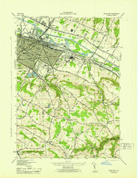
1945 Map of Utica East
USGS Topo · Published 1945About this map
Utica serves as a dense industrial and transport hub at the close of the second World War, defined by the parallel paths of the Mohawk River, the Barge Canal, and the N Y C R R. The city's civic infrastructure is well-documented, featuring the Court House, General Hospital, and the Utica Free Academy. To the east, the Masonic Home and School occupies a significant tract near Realls Cr.
Find a feature on this map
92 named features on this map. Tap any name to fly to it.
Don’t see what you’re looking for? This feature index may not catch every label — zoom into the map to look around manually.
Map Details
Editions of this 1945 Utica East Map
This is the sole edition of this map. No revisions or reprints were ever made.
Other maps of this area

1895 · Oriskany
USGS Topo · 1:62,500

1898 · Utica
USGS Topo · 1:62,500

1898 · Oriskany
USGS Topo · 1:62,500

1900 · Utica
USGS Topo · 1:62,500

1907 · Winfield
USGS Topo · 1:62,500

1907 · Sangerfield
USGS Topo · 1:62,500

1943 · Newport
USGS Topo · 1:24,000

1943 · Utica East
USGS Topo · 1:24,000

1943 · Millers Mills
USGS Topo · 1:24,000

1943 · Cassville
USGS Topo · 1:24,000