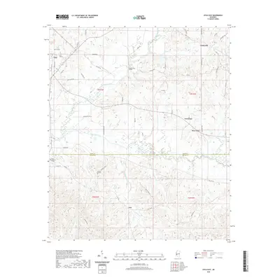
2020 Map of Utica East
USGS Topo · Published 2020About this map
Utica anchor the western edge of this landscape where the borders of Hinds and Copiah counties meet. The area is defined by a dense network of tributaries including White Oak Creek, Tallahalla Creek, and Bear Creek, which carve through the undulating terrain south of the capital region. Educational roots are deep at the Hinds Community College campus, while local history is preserved at the Morning Star Cem and scattered rural settlements such as Chapel Hill, Carmichael, and Jack. A complex system of county roads and distinctive landmarks like the Rather Ford Bridge and Low Water Bridge Rd illustrate the traditional movement patterns across these creek bottoms and ridges. This modern survey provides a clear view of the rural homesteads and family-named roads like Ike Dowe Rd and Johnny Davis Rd that characterize the contemporary settlement of south-central Mississippi.
Find a feature on this map
60 named features on this map. Tap any name to fly to it.
Don’t see what you’re looking for? This feature index may not catch every label — zoom into the map to look around manually.
Map Details
Editions of this 2020 Utica East Map
This is the sole edition of this map. No revisions or reprints were ever made.
Other maps of this area

1903 · Jackson
USGS Topo · 1:125,000

1937 · Terry
USGS Topo · 1:48,000

1943 · Terry
USGS Topo · 1:62,500

1953 · Natchez
USGS Topo · 1:250,000

1955 · Jackson
USGS Topo · 1:250,000

1956 · Natchez
USGS Topo · 1:250,000

1959 · Natchez
USGS Topo · 1:250,000

1961 · Jackson
USGS Topo · 1:250,000

1962 · Jackson
USGS Topo · 1:250,000

1962 · Utica West
USGS Topo · 1:24,000