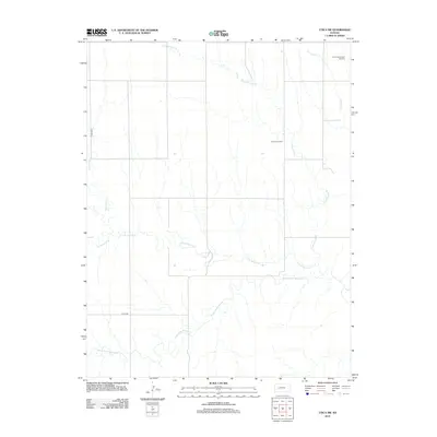
2012 Map of Utica SW
USGS Topo · Published 2012About this map
Arnold Southwest Oil Field and Dumler Oil Field anchor the northeastern sections of this high-plains landscape in Ness County. The area is defined by a dense network of watercourses that feed into the Walnut Creek system, with the N Fork Walnut Cr and Middle Fork Walnut Cr meandering across the southern and central portions of the quadrangle. These drainage patterns, including Cold Springs Br and Wild Horse Cr, illustrate the subtle topographic variations that have shaped land use and resource extraction in this part of western Kansas. The boundary line for Lane-Ness runs along the western edge, following a grid of section roads like Co Rd-180 that partition the territory for agricultural and industrial development.
Find a feature on this map
11 named features on this map. Tap any name to fly to it.
Don’t see what you’re looking for? This feature index may not catch every label — zoom into the map to look around manually.
Map Details
Editions of this 2012 Utica SW Map
This is the sole edition of this map. No revisions or reprints were ever made.
Other maps of this area

1955 · Scott City
USGS Topo · 1:250,000

1958 · Scott City
USGS Topo · 1:250,000

1965 · Beeler
USGS Topo · 1:24,000

1965 · Utica SW
USGS Topo · 1:24,000

1966 · Laird
USGS Topo · 1:24,000

1966 · Utica SE
USGS Topo · 1:24,000

1974 · Alamota
USGS Topo · 1:24,000

1974 · Pendennis
USGS Topo · 1:24,000

1974 · Shields SE
USGS Topo · 1:24,000
1981 · Arnold
USGS Topo · 1:24,000