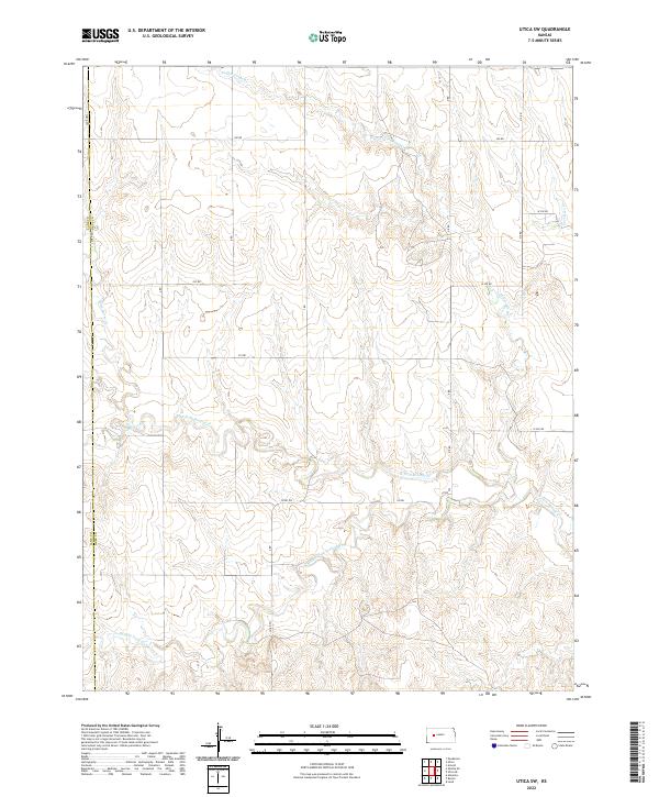
2022 Map of Utica SW
USGS Topo · Published 2022About this map
The Lane Co Ness Co boundary line divides this prairie landscape, where the drainage patterns of the Walnut Creek system dictate the local geography. Several significant tributaries converge in this area, including the Middle Fork Walnut Cr, N Fork Walnut Cr, and Cottonwood Cr. These seasonal waterways carve subtle valleys through the high plains, providing a vital network for local hydrology in an area defined by its agricultural grid.
Find a feature on this map
23 named features on this map. Tap any name to fly to it.
Don’t see what you’re looking for? This feature index may not catch every label — zoom into the map to look around manually.
Map Details
Editions of this 2022 Utica SW Map
This is the sole edition of this map. No revisions or reprints were ever made.
Other maps of this area

1955 · Scott City
USGS Topo · 1:250,000

1958 · Scott City
USGS Topo · 1:250,000

1965 · Beeler
USGS Topo · 1:24,000

1965 · Utica SW
USGS Topo · 1:24,000

1966 · Laird
USGS Topo · 1:24,000

1966 · Utica SE
USGS Topo · 1:24,000

1974 · Alamota
USGS Topo · 1:24,000

1974 · Pendennis
USGS Topo · 1:24,000

1974 · Shields SE
USGS Topo · 1:24,000
1981 · Arnold
USGS Topo · 1:24,000