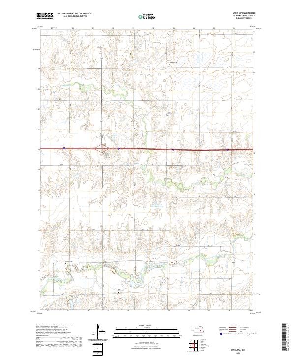
2021 Map of Utica SW
USGS Topo · Published 2021About this map
The winding waters of the West Fork Big Blue River and Beaver Cr define the agricultural landscape of this York County region. The map reveals a deeply rooted rural community, marked by a high density of historical burial grounds that speak to the area's early families. Genealogists can locate Ebenezer Cem, Saint Johns Cem, Gilmore Cem, and the Blue Valley Cem, all situated along the local section-line road network. Water management is a prominent feature of the terrain, visible through the Bulgrin-York County Reservoir, Gray Reservoir, and Bailey Reservoir. These structures, along with the seasonal drainage of Dry Run, illustrate the essential role of water conservation in supporting the Nebraska plains' farming economy. The grid system of roads, such as RD 13 and RD 5, organizes the countryside into a series of predictable blocks typical of the Public Land Survey System.
Find a feature on this map
30 named features on this map. Tap any name to fly to it.
Don’t see what you’re looking for? This feature index may not catch every label — zoom into the map to look around manually.
Map Details
Editions of this 2021 Utica SW Map
This is the sole edition of this map. No revisions or reprints were ever made.
Other maps of this area

1898 · York
USGS Topo · 1:125,000

1899 · York
USGS Topo · 1:125,000

1934 · Utica
USGS Topo · 1:62,500

1937 · Utica
USGS Topo · 1:62,500

1955 · Lincoln
USGS Topo · 1:250,000

1957 · Lincoln
USGS Topo · 1:250,000

1958 · Lincoln
USGS Topo · 1:250,000
1966 · Friend
USGS Topo · 1:24,000
1966 · Beaver Crossing
USGS Topo · 1:24,000
1966 · Utica
USGS Topo · 1:24,000